
That’s the title of this intriguing essay on the Piri Reis map — an early 16th century map that allegedly shows the coastline of Antarctica not covered by ice.
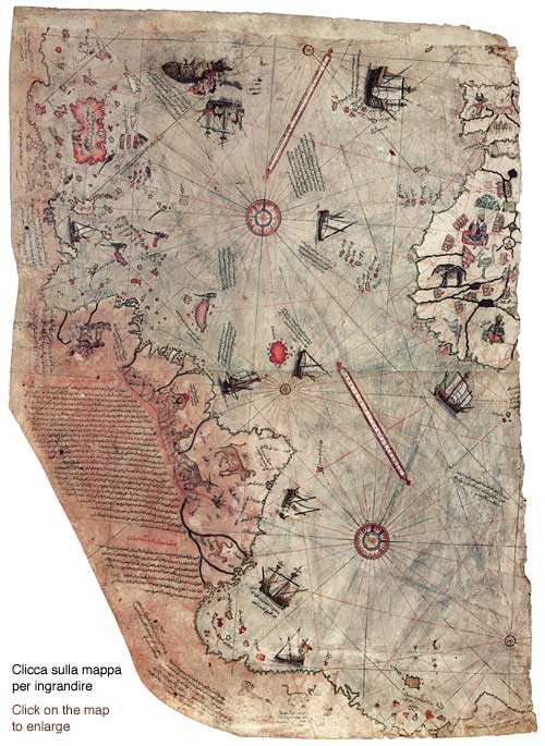
The image above of the Piri Reis map comes from this much longer and more detailed analysis, the effort of art historian Diego Cuoghi. It’s quite a piece of art-historical detective work. Honestly, anything Cuoghi produces is worth your time. He’s the fellow that has thoroughly debunked (I’d use the word “bludgeoned”) the “UFOs in medieval art” nonsense in a truly remarkable series of essays.
Really looking forward to the comments on this one.
Seems to me to be a map of Africa and Asia coastline, cant see how one would get Antarctica.
I hear you